Report to Hikers: week of June 8-June 14

Hello Hikers!


Wednesday June 10

Breakfast at Freddy’s Diner, Newfield – hike in Arnot Forest
Arnot Forest 050

Here’s a test for an aging hiker’s brain:

You’ve been to this remote and undeveloped forest a few times but not in many years — you know there’s a loop walk that can be done because someone led you on it, twice — but there’s no blazes or markings, and no map of any kind. The challenge: Can you remember the loop trail on your own, years later, amid a confusion of unmarked paths and crossroads?

Could I do this? never! That’s why we haven’t attempted this hike in years. But luckily we have the resourceful Tiger — amazingly, she was able to recall the way after so many years and lead us around successfully.
Arnot Forest 095

So now we have another delightful walk to add to our list — with three hikes a week, we need all the good ones we can get. We’ll be coming back out here in the fall before hunting season (we need a cool morning because a lot of the trail is uphill).
Arnot Forest 071

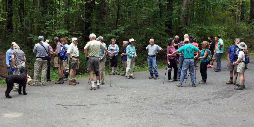
The loop is in deep shade basically the whole time, but we did hit one open sunny spot and I told the hikers to assemble for a photo — as they’ve done before, they insisted I should be taking the shot with the sun shining in their faces — I predicted that wouldn’t look so great.  Judge for yourself  —  (if you don’t know, you can click any photo in these hike reports and you’ll get a high-resolution version  —  click again and you’ll get a blow-up version)

2015-06-10 Arnot Forest1

Official head count: 16 hikers, six dogs.

Freddy’s Diner
A number of the communities outside the city are pretty hip in their own way, with lots of professors living there, or artists or activists or old hippies — Newfield’s not in that group — and Freddy’s is not an enlightened place at all. Official head count for the diner: 12 hikers.

You can see six more photos by me online here.


Saturday June 13

Woodward Road NW to Hines Road, Enfield
Woodard Road to the NW 041

Beautiful mild fresh morning after the awful high 80s heat of Friday afternoon — the path was still wet from the evening’s big storm, and it was muddy and quite slippery on the sharp ups and downs in the woods
Woodard Road to the NW 023

This trail is always beautiful but it seemed especially so this morning, with a pale sun shining through and a lovely breeze.
Woodard Road to the NW 068

We’ve lost the last segment of this walk — the landowner’s withdrawn permission — so now we have to turn around at Hines Road — we miss a couple of great fields but it’s not a fatal change because we can fill in the hike to get two hours by walking east of the cars to look at Fishkill Creek.
Woodard Road to the NW 082

Official head count: 10 hikers, five dogs

You can see seven more photos by me online here


Sunday June 14

South leg of the Abbott Loop from Michigan Hollow Road, Danby

Abbott Loop, south crossing 058

Fantastic walk up my favorite trail

Abbott Loop, south crossing 068

I love everything about this hike, but what I like best is the long level stretch within a ravine about halfway up the hill where several streams converge — they’ve formed a big flood plain that’s full of running water and fallen tumbled-up trees, lush greenery, and mud — this was one of our muddier mornings — I really enjoy navigating mud myself but I realize not everyone else does, so maybe not everyone had quite as much fun as I did

Abbott Loop, south crossing 079

We had to proceed pretty slowly because of the wet slippery conditions so we didn’t get beyond Bald Hill Road — that was good enough for me — it was steamy and the walk is genuinely strenuous so I was happy to turn around and cruise back to the cars just enjoying the gorgeous setting.

Abbott Loop, south crossing 102

Official head count: 21 hikers, eight dogs

You can see eight more photos by me online here.

You can see Annie’s photos online here.

Report to Hikers: week of June 1-June 7

Hello Hikers!


Wednesday June 3

Three obscure side trails, upper Treman State Park

Upper Treman SP 060

There’s lots more to see at upper Treman than just Lucifer Falls  — there are three delightful side trails that take you into some wonderfully varied and beautiful settings  —  but I’ve never gotten the impression many other people are aware of this  —  everyone’s just dazzled and satisfied to see the roaring waterfalls and then call it quits.

Upper Treman SP 099

Our gain  —  we always have the side trails to ourselves, even when the upper parking lot is jumping  —  and you always get the feeling of being off in some isolated part of the county instead of right next to one of the top three tourist attractions in town.

Upper Treman SP 063

We caught a really lovely morning, low 50s, fog hanging on the hillsides on the way to the trail head

Upper Treman SP 023

Official head count:  16 hikers, four dogs

You can see six more photos by me online here.

You can see Annie’s photos online here.


Saturday June 6

Shindagin Hollow Road east to South Road and beyond, Caroline

Shindagin Hollow Lean-to 031

Gorgeous dark cool foggy morning in Shindagin Hollow State Forest  —  it evidently poured overnight when the cold wave came through, and the trail was running with water a lot of the way  —  this is always one of our darkest, most atmospheric walks, and the effect was really intense this time

Shindagin Hollow Lean-to 048

A couple of the hikers had been to the Olympic rain forest in Washington, and they said it felt similar on this trail, especially right around the lean-to, which was built in one of the best pine groves I’ve been to  —  (don’t look too closely at the photo; the lighting was so dim, the photo quality is poor  —  it’s more or less in focus, I think, but terribly pixelated)

Shindagin Hollow Lean-to 069

There’s only a few spots along this entire walk where there’s really enough light to take a decent photo  —  one is this crossing of South Road  —  you can see the fog in the distance  —  I got another photo op when we veered off the trail for a minute to check out this big field, which is actually a very high quality and productive one, according to Jim (far left), who studied crop science at Cornell for some years.

Shindagin Hollow Lean-to 091

A lot of our hikers rate this trail very highly, and it was exceptionally picturesque this time.  One drawback  —  lots of roots and a rough surface on the path, you really need to watch your step.

Official head count:  16 hikers, four dogs

You can see 10 more shots by me online here  —  including this year’s version of the big cairn  —  not the best I’ve ever seen  —  last year’s version was much better.


Sunday June 7

Six Mile Creek from the wildflower preserve to Potter’s Falls

Six Mile wildflower 049

Another great morning on the hiking trail, 10 degrees warmer than Saturday but still delightfully nice

Six Mile wildflower 062

The creek was quite muddy from Friday night’s storms  —  otherwise, picture-postcard conditions, and it’s really wonderful to have the creek in sight for so much of the way on this walk

Six Mile wildflower 111

We had several very good adventures  —  I led one contingent of hikers into the overgrown flood plain upstream from the lower reservoir  —  trying to get to Potter’s Falls by walking the whole way along the creek edge  —  lost my way in the maze of faint trails and marsh grass, hit an un-crossable stretch of water, had to turn back  —  we did some lively creek-jumping in the process  —  one hiker didn’t quite make it across cleanly, got a little wet, all in fun

Six Mile wildflower 132

Then a big contingent of hikers, the dare-devil crowd, kept going after we reached Potter’s Falls, where we always turn around  —  they walked forward along the narrow trail cut into the sheer cliff face of the north gorge wall up to the high dam  —  I foolishly did this trail once myself some years ago  —  most terrifying experience of my adult life.

Official head count:  32 hikers, five dogs.

You can see nine more shots online by me here.

Report to Hikers: week of May 25-31

Hello Hikers!


Wednesday May 27

Finger Lakes Trail from Bald Hill Road to Smiley Hill Road, Danby
Chestnut Lean-to 076

This walk through the northwest corner of Danby State Forest is a great one for a hot day, because it’s almost all in dense shade — it was verging on oppressive at the trail head, but once we stepped into the woods it was mild and lovely. But buggy — the bugs swarmed us as we stood around waiting to start, and they stuck with us throughout.
Chestnut Lean-to 133

One of the high points of the hiking year for me is the emergence of autumn olive blossoms in the woods — I find the intense sweetness almost intoxicating — it was out in full force along this trail and the effect is especially lovely on a sultry morning like this one — regrettably, it’s an invasive species much hated by native-plant types

This is the trail where we had our fabulous early-February hot dog cook-out, and I found myself thinking back on it wistfully as the prospect of a hot summer looms ahead. Since we were last here in February, there’s been considerable logging done along the trail, but it hasn’t changed the character and it’s still a very beautiful walk.
Chestnut Lean-to 112

Official head count: 15 hikers, five dogs

I got some shots of the hikers standing around at the trail head — light not great and some of the shots are a bit overexposed, but they’re usable — click here.

I got seven more shots on the trail — click here.

You can see Annie’s photos here.


Saturday May 30

Upper Buttermilk Falls SP from the Yaple Road spur trail

Upper Buttermilk Falls SP 161

Beautiful dark sultry morning around Late Treman

Upper Buttermilk Falls SP 068

This walk has a great variety of wonderful scenery, but a couple of spots have been damaged recently, in my opinion  —  the charm of this area where Buttermilk Creek flows into Lake Treman under this graceful little bridge was really degraded by a heavy-handed engineering project  —  here’s hoping it’ll recover ….

Upper Buttermilk Falls SP 121

…. damage also at La Tourelle  —  we used to be able to emerge from the woods and stand on the edge of a lovely bucolic lawn and gaze out on the serene resort  —  now the lawn’s been filled with glamping tents and there’s a raw gravel road  —  of course the resort’s entitled to make money, but it’s a shame from our point of view.

Upper Buttermilk Falls SP 096

There’s lots of really gorgeous dark woods along this trail  —  but it’s a waste of time trying to take photos on a gloomy morning like this one  —  here’s a view in an open glade where you  can at least get a glimpse of the woods in the background.

Upper Buttermilk Falls SP 186

Official head count:  19 hikers, five dogs.

You can see nine more shots by me online here.


Sunday May 31

Satterly Hill, Finger Lakes National Forest, Schuyler County

Satterly Hill 131

A cold front moved in overnight  —  the storms that were supposed to hit us kept sailing by just to the north  —  and we had a fantastic atmospheric morning on Satterly Hill, with just a few light sprinkles  —  that’s not to say it was dry  —  we had to wade through long stretches of tall soaking grass and traverse some serious mud

Satterly Hill 089

The clothing of choice for a day like this is official rain pants, in my opinion  —  I wore mine  — roasty toasty  —  but you can’t worry about having a fat-assed look on the trail if you wear this item —  Sue’s actually decidedly slender under her rain gear

Satterly Hill 164

The mud was pretty intense  —  one hiker lost her concentration while crossing this boggy spot, fell over and actually got so stuck in the mud that some other hikers had to pull her out

Satterly Hill 104

The whole hilltop area was foggy so there were no long views to be had  —  but the fantastic lighting and atmospherics more than made up for this loss

Satterly Hill 098

The National Park Service has done some brush cutting and clearing in the last year, and many of the flowering shrubs seem to have disappeared  —  at least I didn’t see or smell any blooming areas  —  but the spring bird-song action was great.

Satterly Hill 088

Official head count:  14 hikers, three dogs.

You can see eight more shots by me here.

You can see Annie’s shots from the hike here.

*********************************

Annie took photos of last Sunday’s walk at Kennedy SF that I didn’t link to before  —  click here.


Report to Hikers: week of May 18-May 24

Hello Hikers!


Wednesday May 20

Willseyville Creek flood plain, Caroline
Wilseyville Creek 097

For the second Wednesday in a row, we were hit with a big weather change just before our hike —stifling hot spell abruptly cleared out overnight, and we shaped up at a raw and breezy trail head — half the group had gloves on when we stepped off.
Wilseyville Creek 011

It was definitely cold waiting to start — and one big group got antsy and burst off down the trail before all the latecomers had trickled in — no big deal, except in this case it led to a mixup  —
Wilseyville Creek 036

This walk consists of three elements: an old railroad right-of-way through a big swamp, a series of lovely sweeping fields, and a huge picturesque pond.  The people who started early didn’t know about the fields and the pond, so they spent the whole time forging ahead up the right-of-way ….
Wilseyville Creek 040

Now, this old train bed has its leafy overgrown charms, but the hikers in the front group missed out on some other great sights.  I should have phoned them right away and told hem to wait for the rest of us, of course  —   except I didn’t think of that until two days later.
Wilseyville Creek 077

Anyway, here’s the big pond that some of us saw — if I’d stood further back, you could see more of it …. it’s really very lovely and striking — alas, none of us got to see the sweeping fields this time; this involves a detour and we ran out of time for this amid the crossed signals.
Wilseyville Creek 119

Official head count: 17 hikers, three dogs.

I took some photos of the hikers’ faces — click here.
You can see seven more action photos by me here.

You can see Annie’s shots from this hike here.


Saturday May 23

Upper Six Mile Creek, from Juniper Drive to the upper reservoir

Upper Six Mile Creek 049

Gorgeous cool morning on the trail after the temperature dipped down below 30 overnight  —  just the right amount of water in the rocky stream bed so it was great fun but not too challenging

Upper Six Mile Creek 093

Beautiful serene mood at the upper reservoir  —  I didn’t get over to the edge of the big dam to photograph the water rushing over, but Annie got some shots  —  here’s the best I have to show  —  our guys are standing on the wall of the dam, which you can just see underfoot ….

Upper Six Mile Creek 102

Very dark shade in the woods, photos generally didn’t work out ….

Upper Six Mile Creek 127

But there was some pleasant lighter shade in a few spots that made for a lovely effect

Upper Six Mile Creek 148

Official head count:  27 hikers, five dogs

Upper Six Mile Creek 020

You can see eight more shots by me online here.

I also got six shots of the hikers navigating the stream bed  —  click here.  Photos a bit grainy because of the low light, but good enough to capture the scene  —  this part of the hike went over very well with the first-timers.

Click here to see Annie’s shots from the hike.


Sunday May 24

Kennedy State Forest, Virgil

Kennedy SF 047

Managed to squeeze in another gorgeous morning on the trail ahead of the latest big heat wave lumbering up from the south — beautifully fresh on the outbound leg, starting to get a little warm on the way back to the cars, but still delightful.

Kennedy SF 073

Some of our walks have a variety of scenery  —  this one is pretty much just pure woods  —  but what woods they are!  they go on and on  —  really exceptionally lovely  ….  very little undergrowth, dramatic light-and-shadow patterns

Kennedy SF 067

There is one change of scene, when we come to Owego Hill Road and walk up that for a little while  —  it has a great country feeling, wonderfully shady, lots of big mud puddles

Kennedy SF 061

Official head count:  15 hikers, five dogs

Kennedy SF 090

As those of you who’ve hiked with us know, I’m always a bit nutty about trying to wrap up our hikes in exactly two hours  —  who cares, right  —  alas, I have no rich inner thoughts like some people do, so this is the kind of mundane thing I think about while I’m walking along  —  I bring this up because we managed to complete both the Sat and the Sun hikes in pretty much precisely two hours  –   yeah!

I didn’t get any extra action shots this time, too shady for good photos, but I did get some face shots while we were standing around that you can see online here.

Report to Hikers: week of May 11-17

Hello Hikers!


Wednesday May 13

Stevens Suspension Bridge, Forest Home, to the high bluffs across Freese Road

Stevens Suspension Bridge 103

Chilly grey breezy morning along Fall Creek, with occasional sprinkles  —  everyone was bundled up  —  some hikers were even wearing gloves  —  it was a complete delight to be cool again after the previous week’s heat wave.

Stevens Suspension Bridge 045

It seems to me that when spring finally arrives every year, the best place to get the full lush and green impact is in the flood plains right along the banks of Fall Creek, where the vegetation always seems a little wild and exuberant  —  it certainly looked beautiful along this stretch.

Stevens Suspension Bridge 081

We walked up into the huge fields along the bluff on the north side of the creek valley  —  I always love the wide open spaces effect, especially on a day when there’s a gloomy cast to the sky

Stevens Suspension Bridge 090

Normally we walk through the Cornell golf course as part of this hike, but this time we went the other direction, across Freese Road and along the high bluffs along the north side of Fall Creek  —  this stretch is really undercut  and dramatic  —  I never get within 15 feet of the edge but Annie got some shots where you can get an idea of what it looks like.

Official head count:  12 hikers, one dog.

You can see seven more photos by me online here.

You can see Annie’s photos from this hike here.


Saturday May 16

Roy H Park Preserve into Hammond Hill SF, Dryden

Roy H Park Preserve 057

Beautiful damp mild morning along Irish Settlement Road  —  we got some decent rain early in the morning and there was still a fresh spring feeling in the air when we stepped off.

Roy H Park Preserve 088

An unusual number of our regulars were out of town or otherwise engaged, including my Tiger, off looking after her brother, who was badly banged up in a motorcycle accident a few weeks ago  —  I’m happily eating a deliciously unhealthy diet while she’s away

Roy H Park Preserve 072

Official head count:  10 hikers, three dogs.

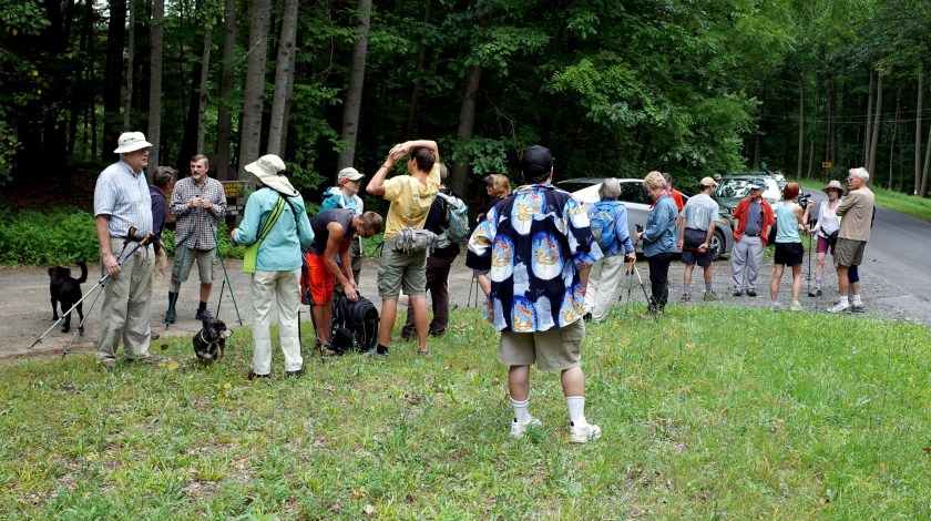
Everyone insisted this photo wouldn’t come out, because I was facing toward the sun and I should have had the sun at my back  —  I argued if the hikers were facing into the sun, they’d all look horrible with the bright glaring light right in their faces lighting up the sags and creases and wrinkles.

Roy H Park Preserve 038

Some mosquitoes …. they were biting other people but none got me  —  one mishap  —  Roger lost his iPhone out of its holster on the way back to the cars  —  he turned back to hunt for it, but a small group of people hiking behind us had already found it and gave it to him

Roy H Park Preserve 114

This trail segment has some great dark-forest action on it  —  as usual, I failed to capture any of it  —  this shot is the next best thing, the dark mass in the background behind Jack B and Betty at least gives a hint of what you can see.

You can see seven more shots by me here.

You can see Annie’s photos here.


Sunday May 17

Monkey Run Natural Area, south side of Fall Creek, Varna

Monkey Run south side 091

More rain overnight, another gorgeous mild morning on the trail.

Monkey Run south side 062

This walk is very popular with the hikers, and understandably so.  It takes us past a whole series of delightful spots, some of which are so dark I don’t bother trying to photograph them  —  so you need to join us if you want to see the whole package.  The top photo shows West Beach  —  the shot right above is the dramatic high bluffs stretch  —  it’s 100 feet straight down  —  as I mentioned, I never approach the edge, but you can see some bluffs shots in Annie’s photo album from this hike, linked below.

Monkey Run south side 108

This is the huge Cornell fields area  —  I always shepherd everyone over here so I can get an unposed group shot  —  I also want them to admire the sweeping open area, but as you can see, no one pays any attention or even seems to notice, they’re so busy talking

Monkey Run south side 128

One of the two east beaches  —  a lovely bucolic spot  —  the last time we were here the creek was frozen solid and we were standing out in the middle on the thick ice.

Monkey Run south side 035

Official head count:  31 hikers, five dogs.

You can see nine more shots by me here.

You can see Annie’s photos here.


Special photo report  —  walk across England  —  by Jack V

IMG_2041

Regular hikers Jack V, John & Kathy finished up a walk from one coast of England to the other last week.  Here are the details, from Jack:

“The Coast to Coast walk is a 192 mile walk across England. Most people start on the west coast at St Bees and walk east to Robin Hood Bay. It goes through 3 national parks: Lake District, Yorkshire Dales and North York Moors. The trail is not a national trail of England and is sometimes difficult to follow. It is a wonderful way to see the different regions of England.

We hiked an average of 13.5 miles per day with the longest being about 26 and the shortest 8. We stayed at B&Bs, all very high quality. The food was very good, we sometimes ate dinner at the B&B and other times at a pub. The weather had everything: rain, snow, hail, strong wind, cold and sun shine. We had about 5 beautiful day for hiking out of 14.”

Click here to see Jack’s photo album from the trip.