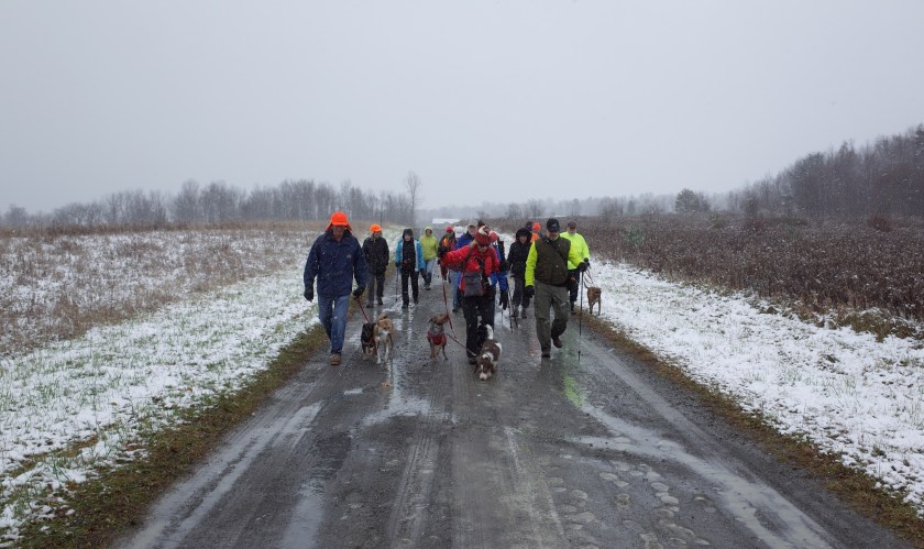
Report to Hikers: week of Nov 28-Dec 4


Hello Hikers!


Thursday Dec 1

Ellis Hollow Nature Preserve

r0110356-2r0110378-2r0110380-2r0110390-2r0110423-2r0110425-2Official head count:  19H, three D

You can see Jack V’s photos here


Saturday Dec 3

Rim trail, Taughannock Falls SP

r0110439-2r0110460-2r0110497-2r0110499-2r0110510r0110522-2r0110567-2r0110586-2r0110600-2Beautiful gloomy atmospherics, just like I hoped for  —  raining lightly on the way to the hike  —  rained lightly on the way home  —  misty, a little breezy in spots

r0110482Official head count:  21H, 10 D

You can see Jack V’s photos here


Sunday Dec 4

Treman SP on the FLT

r0110614-3

r0110645-2r0110650-2r0110656-2r0110706-2r0110726-2I made everyone line up for a group shot on the way up the steep hill, but the result looked a bit stiff  —  I like this shot better  —  this is about half of the group as the line-up was breaking up  —  has a more relaxed feeling

r0110740-2

r0110747-2r0110771

Official head count:  29H, eight D

You can see Jack V’s photos here

Report to Hikers: week of Nov 21-Nov 27


Hello Hikers!


Wednesday Nov 23

Stevens Suspension Bridge and Fall Creek Natural Area

aviary-photo_131244565028519381r0109813-2r0109833r0109843-2r0109865-2r0109886-2r0109911-2r0109947-2The snow became extremely deep in places up in the big fields, and the walking got so hard we turned back  —  Norm getting the snow out of his boots ….

Toward the end, the sun came out and we ended up at the arboretum look-out  —  lovely morning

r0109964-2Official head count:  15H, 5 D

You can see Jack V’s photos here


Thanksgiving Day

Get-together at Katharine and Scott’s, Danby

r0109977Tiger and I had visitors so we were only able to drop by for a little while —  very cheerful warm vibe

Official head count  —  as per Scott:  33 people, four dogs and two cats


Saturday Nov 26

Road walk, Taber Hill Farms, west of Mecklenburg on Route 79

r0109988A bit raw at the meet-up ….  chilly nagging breeze and raining ….
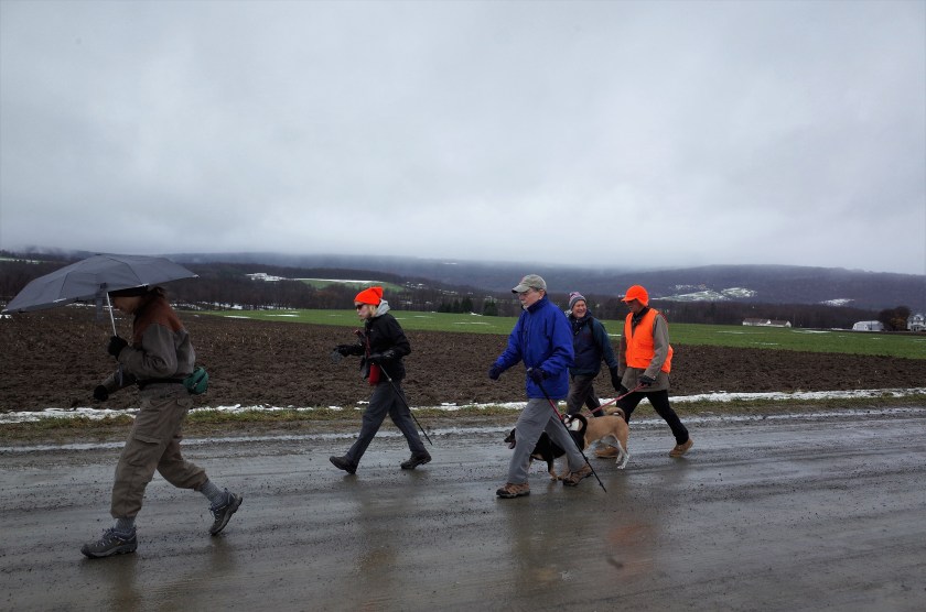
r0110017…. but we managed to warm up pretty fast by walking briskly up the hill away from Route 79

r0110126-2

r0110112…. and if you like bleak and melancholy late fall scenery (I do), it was a fantastic walk

r0110171My only complaint is that the slopes in this area are pretty gradual and I like it when the land rolls a little more vigorously

r0110172-2On the other hand, the long views are spectacular  —  at one point I looked around and there were distant hills visible around the entire 360-degree horizon  —  no way to capture that in a photograph, of course  —  it was really striking

r0110067-2Several of the hikers said they want to come back in early spring when the leaves are just coming out, and also in fall when the leaves are turning, to get a whole different color experience in the cyclorama setting

Official head count:  12H, four D

You can see Jack V’s photos here


Sunday Nov 27

Lime Hollow Nature Preserve, McLean

r0110199-2r0110203-2r0110217-2r0110234-2aviary-photo_131247485112184711r0110277-2r0110299-2r0110312r0110320-2Official head count:  23H

You can see Jack V’s photos here


Holiday events coming up

Christmas Day get-together at Iris’s  —  probably with a turkey

New Year’s Day tailgate party


Report to Hikers: week of Nov 14-Nov 20


Hello Hikers!


Wednesday Nov 16

Road walk  —  Legge Hill Road from Honeypot Road to Lathrop Hill Road and beyond, Candor

r0109348-2r0109363-2r0109380-2First time we walked on this road  —  I decided we should try it without ever having been here  —  I picked it out just by looking at Google maps  —  I thought it looked really promising but it was far more beautiful than I’d hoped  —  it helped that it was a wonderful mild morning

r0109433-2r0109458-2r0109475-2I love to walk in the woods, of course, but when we can find a country road like this one, I like it on the road just as much

r0109481-2r0109495-2r0109526-2Official head count:  18H, four D

You can see Jack V’s photos here


Saturday Nov 19

Upper Buttermilk Falls SP

r0109536-2r0109564-2r0109576-2r0109586-2r0109607-2r0109618-2

r0109627-3

r0109637-2Official head count:  40H, 12 D (a new record for us, I think)

You can see Annie’s photos online here


Sunday Nov 20

Upper Treman SP

r0109673-2r0109681-2r0109704-2r0109716-2r0109721-2r0109731-2We had a little bit of an adventure  —  we wanted to cross Fishkill Creek but the water was high and the rocks very slippery  —  one group made it across but the rest of us chickened out  —  some of those who crossed recrossed back, the others forged ahead on the other side and met up with us later  —  fun!

r0109753-2r0109755-2r0109760-2r0109775-2Those of you who fly around for pleasure have probably hiked in summer conditions one day and winter conditions the next, but for those of us stay-at-home hikers it was an interesting experience.  I was a little surprised to find that I enjoyed Sunday’s wintry hike just as much as Saturday’s balmy one  —  though of course it wasn’t truly cold Sunday, so it wasn’t a perfect experiment.

Official head count:  18H, seven D

You can see Jack V’s photos here

Report to Hikers: week of Nov 7-Nov 13


Hello Hikers


Wednesday Nov 9

Woodard Road NW toward Porter Hill Road, Enfield

r0108798-2Classic fall morning, drizzling a little, gloomy skies, upper 40s  —  not everyone’s idea of a great day but I really love these conditions

r0108802-2r0108809-2r0108810-2r0108829-2We’ve had to cut this walk short for the last few years because a landowner withdrew permission for access, but that was just recently remedied, and the new trail is lovely

aviary-photo_131231965567313960r0108849-2r0108893-2Official head count:  14H, one D


Saturday Nov 12

Carter Creek Loop, Connecticut Hill WMA

r0108944-2r0108952-2r0109015-2r0109036-2r0109055

r0109097r0109111-2This is an excellent trail with a number of very beautiful stretches  —  looked especially lovely with the bright slanting sunlight and the long shadows

Official head count:  26H, eight D

More photos online:

Annie

Jack V


Sunday Nov 13

Hammond Hill SF ski trails

aviary-photo_131235894039567731r0109212-2r0109246-2r0109260-2r0109267-2aviary-photo_131235388865972141r0109303-2r0109315-2More gorgeous weather  —  another great walk

Official head count:  32H, 11 D

Report to Hikers: week of Oct 31-Nov 6


Hello Hikers!


Wednesday Nov 2

Watkins Glen

r0108252-2r0108263-2You can be forced to wait in line to get into this fabulous gorge in season  —  the trick is to come in November, early in the day  —  we pretty much had the main parking lot and the trail to ourselves

r0108284-2r0108296-2r0108300-2On the theory that it’s safer for an old, somewhat shaky group of hikers to go up the steps rather than to go down, we walk back along the rim, which is just a typical trail

r0108346-2r0108358-2Nice lookout dating from 80 years ago  —  to bad there’s no longer any view to see, because lots of trees have grown up.  Advice to DEC:  Cut them down!

There are great views from this bridge ….

Unfortunately, the walk up the gorge and back down the rim doesn’t add up to two hours  —  but you can explore some beautiful trails along the south side, and there are other sights to see

r0108383-2r0108385-2r0108426-2Official head count:  24H

You can see Jack V’s photos here


Saturday Nov 5

Gorge Trail, Finger Lakes National Forest, Schuyler County

aviary-photo_131228894964372255r0108480-2r0108492-2r0108494-2r0108522-2r0108528-2r0108539-3r0108564-2

Official head count:  27H, four D

More photos online:

Annie

Jack V


Sunday Nov 6

Shindagin Hollow SF, Braley Hill Road to Shindagin Hollow Road on the FLT

r0108608-2r0108635-2r0108683-2r0108690-2r0108708-2r0108736-3r0108762-2r0108772-2Official head count:  39H, 11 D (possibly a record)

More photos online:

Annie

Jack V

******

Update on our Thanksgiving get-together

Looks like two hikers will each roast a turkey  —  stay tuned

******

Want to map the hikes?

Here’s a recommendation from regular Sunday hiker Jack B


“Several fellow hikers have asked about the app we sometimes use to track our hikes.  Here is some info that you might want to pass on to the group..

The app is called Maps.ME  (used to be called Maps with Me).  It uses the GPS in iPhones, iPads, and Android devices to show you where you are without requiring a data connection. Instead, you download free maps ahead of time of the area where you are going to be. Turn on the app and it shows you on the map where you are. It lets you mark places as bookmarks, plan routs to somewhere, and even record a “recent track”.  I used that this morning and it recorded a nice set of dots along our hike trajectory. You can save these if you want.  Everything is free and they have maps for all over the world. Many maps even show trails (we used this for hiking an obscure trail in Norway a few years ago).  To get it, just go to the relevant app store for your device and download it.  A recent manual on what it does and how to use it is online at:  https://maps.me/files/MAPS.ME%20User%20Guide%203.0.pdf.   There are also YouTube videos showing you how to use the app.  The critical point is that you do NOT need a data or phone connections to use this app. Very cool.

Jack

PS. The manual dos not include all the recent features included in the current app, such as the Recent Track option. You may have to experiment with that as I did today.”